Introduction
Welcome to the Plant Imaging and Carbon Transformation Research Group at the University of Windsor School of Environment. Our research focuses on two broad areas: (i) Plant Imaging: the development of remote sensing and close range imaging methods to obtain high quality measurements of plant biophysical and biochemical traits and their influence on root-soil-microbial interactions, and (ii) Carbon Transformation: tracing the progression of plant-borne carbon and its subsequent fate through empirical observation and the development of mathematical models of complex ecological systems with the goal of identifying the key mechanisms underlying the behavior of the system as a whole.
The Principal Investigator, Cameron Proctor, DPhil (University of Toronto), is an remote sensing scientist who applies his craft to spatial biogeochemistry questions.He is currently an Assistant Professor in the School of Environment at the University of Windsor. He is a past recipient of an NSERC Postdoctoral Fellowship and NSERC Alexander Graham Bell Canada Doctoral Scholarships. For more details, you can read his CV here.
Proctor’s research interests include wetland ecology, rhizosphere microbiology, unmanned aerial vehicles (UAV), image analysis, GIScience, big data, and spatial analysis. His research outputs cross between remote sensing and biogeochemistry and he has made important contributions to the development of UAV hyperspectral remote sensing. His recent research has included quantifying the quantity and quality of carbon deposited to the wetland methanogenic community via the root exudation pathway, simulation of root exudation gradients accounting for soil properties, and development of radiative transfer models to simulate the spectral evolution of monocot leaves during decomposition. The long-term vision of his research is to understand the mechanisms regulating belowground carbon deposition and their functional significance in wetland carbon cycling. He focus on the underlying root-mediated processes and their implementation in landscape-scale models that predict greenhouse gas exchanges in contemporary and altered climates. As wetlands are poorly mapped, he investigates whether improving the level of detail in remotely sensed imagery can yield improved estimates of root abundance, distribution, and root-mediated processes such as carbon deposition.
Spatial Scales of Research
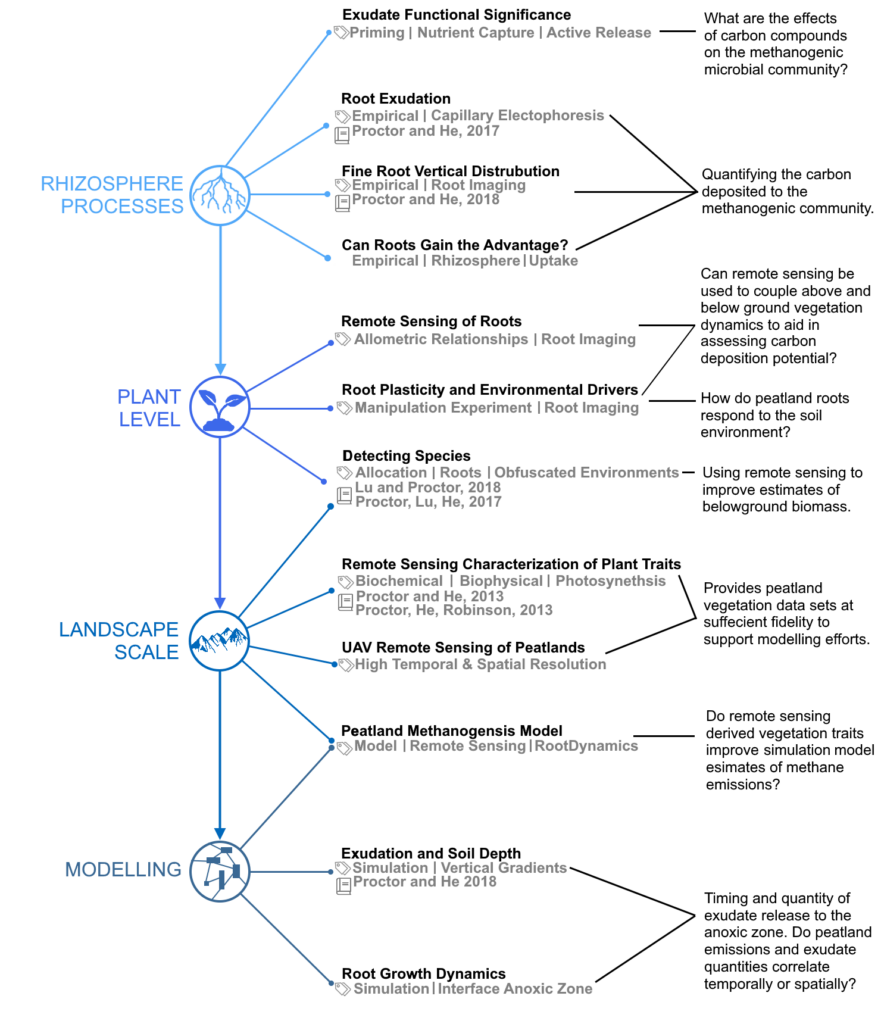
Past research outputs investigate carbon transformation spatially at the landscape, plant, and rhizosphere scale.
Multiscale investigations provide complimentary insights into the complex belowground carbon cascade, and are diagnostic of the relative importance of various carbon processing pathways, and regulators of the overall carbon balance.

